Sunday, October 31, 2010

Another perfect weekend?

hitched back from west coast on friday. sweet english bloke from the UK, Richard, picks me up. He's keen to climb and runs to the boulders at castle hill for a quick onsight, then ends up staying. we wander around the city all day sat, looking for bouldering mat making supplies and cosutmes. Go to littleton market, find yummy chocolates from Shes chocolates, some vegges and some fresh fuji apple juice form local farmer. Go to get a nice coffee. Later, after I study for a bit in the park while rich continues looking for a bouldering pad, a stop at a random garage sale gives me my costume for the night!

Party at Liz's- good to see mark again. some nice costumes, me as jack skeliton, Rich as a skanky cop (rowenas costume) liz a witch, Abie's friend with an awesome masquerade mask. Ania from wien warm and bubly, nice to talk to. We used Morten's ginger brew and made dark and stormies, also used yummy drinks with littleton market juice and the vodka pear rich and I bought. people leave. richard shoudlnt drive so we stay. me Anjia, liz, richard begin acrobatics. first crossslegged rolls (in circles very fun) then headstands and hand stands. Rich then leads me through an amazing set of acrobatics, into tear drop. Then bases others and leads them through too. The amazing spider web decorations get torn down and we sleep in exhaustion.

Well I didn't sleep, mind awake and tumbling, I didnt sleep for a long time. Fitful and woke up early. so I went out on front porch to meditate - hard to find focus. then yoga on the upper deck as the sun rose higher and warmed up. I felt comfy in my new found pants. lazy morning, playing with balloons downstairs.... then off to the beach for a while. more hand stands. and I got buried in da sand completly! they couldnt see me! sand was nice and warm while wind zieht. go into coffee shop at the pier and enjoy a chai.

Then into town for slacklining sesh. Rosa falls asleep and we wrap her in my sleeping bag. Liz has amazing focus and got some really nice moments of balance on the line - SO sweet to see! Zoe - with sick dreds! - was from CPIT and good form in acrobatics. More hand stands, headstands, richard shows off flag and I kinda get half flag. Dragon was sweet, so was wallaby. On the line we tried some yoga poses, learning together. Teaching eachother zoe is close to standing from sitting, while I am close to spinning. we also did some juggling... just a tad.

ah...

Rich has sparked so much learning about body balance and posture!

Also then a bike ride into the wind to the beach (16km) only took 35 min. At ania's and marias a party is held and as I am early a sweet footbag sesh ensues. Great fun with maria. Also got out my sphere out for the first time in a while. Chris (a friend of richards) was captivated and stole my sphere often in following days and showed much improvment. Lots of Germans/Austriens at the party, so I practiced me Deutsche. Also was a feiry, prancing around with anna and chasing rosa and playing with an elephant pillow. sweet sweet

...much fun, a bit lax on the studying but i got what i needed done and had great connections with people!

Monday, October 25, 2010

Perfect weekend?


The combination of events that played out from Friday to Monday, both in and around Christchurch, made it one of the best weekends of my time in Christchurch.


Always mindful of the moon and it’s phases I headed out Friday afternoon to Sumner beach to await moon rise and hope for a nice sunset. The bike over was lovely and exhilarating, even into the wind I felt quick and fast as I lept from stop lights and sprinted over the bridge and along the coast. I first wandered the cave at Sumner, noting the play of sunlight and water as it rushed back and forth. I then alternated between kite flying in the light sea breeze, contact juggling, and juggling the pink volleyball I brought from the flat. The pale blue shadow of my sphere rolled over soft sand that caressed toes and retained the warmth of day.


As I waited with slack kite lines for the breeze to resume I noticed some folks setting up a volleyball net. I wandered over, kicking and juggling the volleyball. They had three little kids with them as well, two boys and a spirited girl. We got the net firmly anchored and soon began to play. The youngins would serve occasionally and the girl joined a bit more (though she was also involved in a sand throwing war with one of the guys). Fun relaxed game as the sun went behind Mt Pleasant (a bit of rosy cloud but nothing spectacular). The kids were getting tired and as dusk progressed we parted ways and hoped to meet again.

I had noticed a gaggle of young folks arrive with shovels and now went over to see what they were doing. I sat down with one of the girls looking on and conversed for a bit. They were a youth group originally come to make sand castles, instead they had made two deep pits and connected them with a tunnel. I shared my story and tossed the disk with some of the others. They unfortunately decided to destroy their tunnel and fill in their holes ‘for the safety of other beach goers.’ I thought this a shame but helped stomp on the tunnel and kick sand in the pit. They then went on their way. As I walked back to my things one of the boys ran out to me and asked if I needed a ride or place to stay. I clarified that I had a flat and had biked out, if they had room for a bike I might come but I was fine biking so dont worry about it. Very sweet kindness to receive. He ran back and I turned back towards the sea with a smile: the rising moon there broadened my smile as it shimmered in the waves. My bike back was a joy, even if it was cooler; swift exertion while waving at passerby and cars with a large smile.


~


As a fundraiser for earthquake victims and a thank you to all those who volunteered and assisted in the aftermath of the earthquake a festival of sorts had been organized for Saturday. A line up of kiwi bands were set to amuse the crowds from morning tell dark. I brought my toys and some lunch. I wandered Hagley park looking for a slackline but found none. So I went to the back of the crowed where the sound was fine and I also had enough space to get my kite out. But first I stopped where a disk was flying to meet a girl from boulder keen to climb and play Frisbee. We tossed for awhile, with some of the adolescent too cool kiwi kids joining in from time to time (trying not to enjoy it too much).


Danach I got my kite out and it’s swooping dives and tacks soon drew a gaggle of children leaping and chasing after it, my dives became more and more risky until at last a kid caught the kite (or did I fly it into him... ^.^) . It was soon relaunched and the ordeal repeated until the wind abated and I could no longer keep the kite from their clutches. Then they wanted to try and fly and when a bit of wind puffed I gave them a go. Two of the kids were twins and I had trouble telling them apart, another was very keen on punching me in the balls, not so nice. They all got a turn at the kite, with varying success and a few scenes of brotherly love.

I then left the kite to juggle a soccer ball a bit with some kiwis and then wander off to see if I found anyone I knew. I ran into Tom and his flatties and settled down to eat some lunch. A group of pissed kiwis near us was making some human pyramids and I decided to go partake. No kneeling pyramids here, we were doing it like the Chinese: standing on each others shoulders. We got three on the base to support one, then two. And then got four on the base to support two and three. Finally we got four-three-one! Three men tall we stood for a bit until balance was lost or one of the base collapsed and then we all fell down without incident.

Back with Tom and company we get out the Frisbee and toss around, tom keeps missing his throws and almost hitting people. All the while I’m getting festive and jumping, dancing about like a fool. A gaggle of girls comes charging by as a dancing phalanx, and then surrounds me and we dance and move. The song ends and they want me to lead a dancing phalanx to the front. I tell them to start it and I’ll join in and help recruit. A few minutes later they come by, I join in, and they fall back and force me to the front - oh well. Party on! I continue and call others forth to join the line while leading those behind in ridiculous moves. We go by the kids I’d seen earlier and they join in. The girls are year nines so I try and encourage the young lads to make the most of this opportunity to impress the ladies. Fun leading - dancing- performing. The kids follow me back to my friends and soon they are jumping all over them as well. We spin em around and wrestle and throw the Frisbee, and then dance when the girls show up - er dance more since I was always dancing. Oh and avoiding getting punched by that one boy... At last I carry the kids over to their parents as a ‘special delivery’ and run off before they can catch me again. Dusk is falling and my friends and I move up to the front for the lat songs where we mosh around and I dance my hair out. Cashel street I am waiting...


~


The moon is red as it rises over the city and I amble home to sweet dreams before an early morning. I meet Tom back at his place where we get a ride with Darren, Emily, kyle and Jon into Arthur's Pass. Tom and I tackle Avalanche peak to make use of our rented snow gear while the rest go on to otihake hot pools (and get eaten by sandflies! Hua-haha,haa). Steep but easy four hour climb to the summit. Coming out of the bush (you wont believe it but it was actually THIN bush: dry and slightly less than lush) was great and offered sweet views of the falls across the valley: devils punch bowl and Bridal Vail Falls. We get our ice axes out more for good form than out of necessity for the last hundred meters of the ridge. The ridge drops sharply right with dramatic rocks and gullies. The snow covered peaks farther west and a small glacier their draw our gazes from the trail at our feet. We gain the summit and some tens of minutes later the clouds begin to obstruct our view and then drift about us. But not before we eat lunch and some Keas (only alpine parrot in the world) show up to see what they can get. We joke about

one of them steeling an ice axe and then while I’m rummaging in my pack one grabs my big jar of peanut butter and soars off with his mate in tow crying ‘kea’ in triumph. Incredulous Tom watched the whole affair occur within a meter of him with his camera in hand... Useless! We slowly and nonchalantly make our way down, tom now having recovered form the previous nights beverages which he managed to keep down. The cloud never blankets us but the light gets dull and the views less magnificent - or not. We wander down the road in the village with thumbs out stretched, looking for a good spot to hitch from but without much thought. As we’re debating a sudden end in the side walk and whether it should continue up the little hill in front of us a car pulls up and lo we have a ride!

Und sind Deutscher! Girls without much of a destination, got a cheap rental car in picton and trying to drive and see a lot. I encourage them to take their time and stop frequently as we continue through Arthur's pass. They take my advice and lucky for us all the weather cleared and they got out to see the Waimakariri river bathed in sun. Gorgeouse vistas of blue water braided through the stones, tall mountains mountains rising steeply from the flat valley, and the receding snow line still sheathing the high peaks about the divide up-valley. Some cloud is about but coming into castle hill the sky above clears and we encourage the girls to stop and see the magical place. I show them some spots including a scramble past the nook pictured right to the top of a boulder and a high vantage. Then we wander about, Tom finds some cool little problems for me to try in my tramping boots. Margret has climbing shoes but no experience so we dont bother with the easy climbs I know and just make up our own little scrambles instead. And soon we just move, hold and, Dance on the rocks. Sweet new vision through which to interact with the stones. Dusk is coming, so we move out, scrambling down a neat shoot and tunnel. The sky meanwhile is under invasion, cumulolentuculars of a soft orange pink have moved in saucer like. Our departure from magic rock is delayed a bit longer: we walk slower (past the cows) to lengthen our exposure to the magical stacks of pancakes, floating above the giant mountains of scree.


Night descended and I describe the bland countryside on the strait shot to Christchurch from Springfield - barring two slight curves, sorry. On the left we have what used to be pine forest and has been recently cleared and reseeded for cattle grazing, on the right giant hedges of the invasive gorse, on the left an asparagus stand I still haven't stopped at, more hedges, oh and you might see a hawk circling - if it wasn’t night. We drop off tom, and I get my bike and race off to guide them to my place - they clock me in their car and said I was going over 40kmh. We share food and make a yummy stir fry with beetroot and watercress adding to more common place veggies and with a peanut and coconut base. Enjoy some wine, tell stories, yack in German, share plans. Lots of smiles, and chocolate too,I finish the night adding some finishing touches to some sketches. The two get up early to experience as much of the drive up the east

coast to Picton as possible. Margret makes a yummy oatmeal and some tea which we enjoy before parting. Unfortunately Margret’s sleeping bag was discovered shortly thereafter under one of the couches. Luckily I had thier phone number, but it was off. I packed it up and sent it the following day up to aukland for her to pick up there. I do hope she still got to do the Tongariro crossing in spite of missing her bag.


The rest of Monday was precious as well, with lectures done and study week begun I had the day to myself and began by running errands at a leisurely pace. Saddly I forgot to bring a bag to the grocery store and as I was riding the plastic bag hit the spokes, ripped, and expelled its contents on the street: sending strawberries flying. I then dropped in on Liz who had caught fever. I took Rosa up for some toast and we wandered around outside, finding flowers and exploring the jungle seat. Nice to then sit inside with them, holding Liz’s burning head, lending my strength. But I had an appointment and soon rushed off through the sunny streets back to my own flat. I started chopping... I think there was rhubarb, if not there sure were apples and the strawberries I saved from road rash. Phoebe came and chopped a bit and then mixed the crumble to a perfect consistency. Put it all in an angle food cake dish and set it to bake while we explored wwoofing options. With the house smelling sweet we took the crumble out of the oven and sat on the front porch and ate the steaming amazing sweetness strait out of the pan in the golden sun of springtime in Christchurch.


I’d end there but I want to add that I played Frisbee for the first time that evening and had a great time subbing and playing savage for an afternoon, a few decent d’s and I thought my cutting was good if not too sharp. Throws a bit rusty, I couldn't thread the needle so well. A beer and some treats after as the sun set and then bike home with fabian for another yummy salmon Monday with the flat (and James and Grant of course, plus the none flatting flatmates Horst and Fabian)


Cheers! .


Kelly to Taipo

I had a major assignment due on friday. Then on account of the lecturer not covering the material needed for the assignment, we got a weeklong extension. Suddenly I had the weekend free (relatively). I was itching for snow, but deteriorating conditions on sunday made barker hut and the Harman pass rout to Julia inadvisable. Instead I set my eyes on Carroll hut with and easy walk down to Dillon hut with day trip options and an easy walk out from there. I went to lab, and while other students raged at Tea Party I started out.

HOW!

The hitch was fine. He told me a bit about the hut, the track and some other tracks on the west coast. He went up to the car park and dropped me there by Kelley's Creek. The track led over a side stream and then it was strait up from there. The track followed what was barely ridge as it climbed the side of the valley in switchbacks that barely traversed. going up you held on to roots and small trees, not so much to keep from falling, but because they were there and you might as well. My pack was full with three days of good food, plus the snow gear that probably wouldn't see any use on the melted tops of the kelly range. The trail took a little traverse at the end of the beech forrest rising slowly into scrub, and then continued with some easy traverses through into the subalpine and alpine regions. I came across some piles of snow, remnants of avalanches mostly. (and there is a lovely little brown creeper (bird) on the rose bush next to me... ). For these sections of snow I got my ice axe out for stability and the off chance that I needed to self arrest. I dropped my water bottle and had to down climb some scree to retrieve it but the snow was fine.

I came up out of the valley and into the basin containing the Carrol hut. patches of snow covering tussocks and sphagnum moss, boulders scattered, and a stream cutting deeply through the middle. I drank in the view up Kelly's creek at the ridge opposite, the otira valley cutting down from the left. I went to a rise, set my pack down and took out my kite to dance in the breeze funneling down the basin. Dancing on the odd puffs and holes that form over the undulating curves of the basin, flying over the edge, a rise, a dip. Looking on and out and over:


Daylight was still abundant and I set my sights on the 1500 m summit nearby. I let the flash hut briefly impress me before setting out with sketchbook and jacket for the slightly snow tops. An easy ridge over the stream led to the north and the summit there. on the one side snow had drifted and been baked by the sun to form a rippling surface. A face bare of snow exposed jagged rocks to the lowering solar disk.


The summit was topped with a research stattion. from there I looked out to the clouds over the west coast, the building rain forecasted for sunday. Below the clouds a river meandered, mirroring the light blue skies above as it did. The clouds themselves blanketed the lower ridges and washed up against the peaks that poked out of the cotton mass. The station had a telephone pole which I climbed up to better feel the wind flowing over that peak. The snow field behind the station was an enticing sledding hill, but I wasn't in the mood for snowy boots. After a few sketches I made my way down to the saddle above the hut. The saddle contained a few scattered tarns: one surrounded in patchy snow in a sea of golden tussock, the other at the bottom of a creeping mass of snow. At the head of the latter a neat cave had formed under the mass of snow. A cave fit for Ludwig's crazy imaginings and Wagner's plays.


I had soon filled my water bottle and was back in the hut steaming vegetables as the sunlight faded from the mountains. No dehydrated food on this trip. Tonight I feasted on quinoa and fresh veggies. I actually made too many veggies and snacked on them all the following day. Before the night finished I tried to catch some alpen glow, some stars. They stretched above, partially hidden by a bright half moon. The milky way was a whiff, but the southern cross and the pointers blazed.


Morning came, I felt as though I had overslept. The hut was cool, but not as cold as I expected. The basin was in shadow and while I ate I waited for the sun to appear. It did, and soon I was following a ridge with it at my back. I decided to leave the route, which passes the tarns of the night before and then traverses the northwest side of the kelly range before descending down to Dillon hut, and follow the ridge-line to the summit of the Kelly Range instead.

A nice mellow walk on gentil slopes. Tussocks and some scattered patches of snow formed the path between patches of scree and the larger boulders scattered about. Some false summits appeared. On the left the slopes steepened to near vertical scree slopes leading into the trees of Kelly's Creek. But on the right were rolling hills of that straw gold tussock. A mellow accent and pleasant foreground for the puffy pillows of cloud that lapped the peaks to the west.

Soon I was at the saddle, a landmark I had identified on my topo after which I would climb to that highest point on the range. Some saddle it was, certainly not a pass, with the scree slopes sliding away to the left. In the middle though was a nice frozen tarn with a small ice fall on it's right bank. farther to the right were more tarns, and just visible was the marked route down to Dillon's hut. Up to the summit: round mellow and bald, not too windy. I got out my topo and assessed the options. It was such a nice day and the prospect of relaxing in a hot pool at Julia hut possesed me. I chose to continue the length of the range and bushwack down to the confluence of Hunt's creek and the Taipo river to then follow the Taipo for some ten kilometers to Julia Hut.

It started out well enough, more pleasant round tops, a nice tarn here, and scree slope there, a snow slope to do a bit of sliding on. The sky was blue and the tops glistened with just a whisper of wind. I dropped down the ridge, sighting my route and was suddenly in dense scrub hiding ankle twisting holes. The scrub soon, but not soon enough, turned to bush. The bush was slightly easier to get through. Now I could descend in a continuous fall, the branches of tress wrapping and tangling around me as a sort of seatbelt that I was continually breaking as I pushed myself down. I could no longer see out of the bush to check and correct my route. I stumbled, bashed, pushed, fell on faith. Now and then in the density of it all a path would seem to appear. I would try to follow it but it would just as soon vanish in the tangle of it all. At last one of these paths sustained long enough for me to feel almost normal... just an overgrown trail. I identified the trail as a deer or goat path by frequent prints in the soft earth. When the trail would vanish I looked to follow the tracks, some times I could, sometimes I couldn't. But now I was continually finding the creatures tracks and soon water soudns could be heard. I hoped it wasnt the gully of Hunts Stream, but I also hoped I wasn't too far west, where the slopes bluffed out above the taipo river. I judged by the sun and wove down the steep slopes. In the end I was a bit into Hunt's Stream gully, but not by much, and here I found the old, unmaintained path that goes up the gully. So I avoided the bluffs and came out at the water's confluence. Glad to be in the sunshine I crossed Hunt's stream, the Taipo River, then walked up river a bit to some flats and enjoyed a good chow. It was great to recharge and soak up some sun after toiling through the bush for so long. The bush was fun, but a lot of effort. Also there's little sun there so it had felt late in the day. The sun though was just past two - I had all the time in the world for the relativly easy 10km up valley.

The path stuck to the bank of the Taipo River as it wound up valley. though the way it did varied as the river spread across the valley or squeezed through a neck. First on broad plains with gauss and small shriveled beech like those seen on the snakeskin saddle route. The path vanished in the grasses, washed away by the winter's snow. Red moss covered rocks scattered across a dry braid of stream that occasionally flows from the mountains - a few cairns scattered indicating former trails. Side streams of the Taipo find a more leisurely pace right at the edge of the valley while the river proper flows in the middle. I get to boulder hop across the streams, or wade through them. Orange triangles indicate the trail when there are trees, and a large one calls me up onto the side walls of the valley. Some sections of steep climbing and traversing on steep slopes continue the way where the valley is narrow. Just meters below you can see the River and little side pools through the moss and branches. Some hours pass - another widening, another constriction. At a widening a side trail seemed more worn than the main so I followed it. In a little clearing there stood Mid Taipo hut: a cozy, long, hut with 6 bunks and a nice little stove. I really liked the counter/desk for cooking on. A nice hut to stay at though I didnt much care for the surrounding area, probably good if your hunting in the bush.

The hut marked a mental halfway point to Julia hut. Just after I crossed the Taipo River via a swing bridge. The trail then stayed higher on the bank, with only one or two widening of the valley. Even when it did broaden, the track on the true right of the river, where I was, stayed high while the bush thinned and afforded lovely views of the river and up valley. The valley wall had a curious terrace. It resembled a vehicle track at times, had a stoney surface and many side streams could be seen running into it and then off again. The track followed this groove/stream/terrace for much of the remainder of the day. Going up a hill I debated the journey and the destination and decided it was time for a snack. Not the most scenic, but a good spot to listen and watch the ordinary while enjoying a cliff bar. I noted some nice waterfalls to the side. one I recall was mostly hidden, but roared loudly, and I could just glimpse it's short but broad and mighty cascade through the low trees. The stream it fed was also hidden, flowing semi parallel to the track and then vanishing. The small streams that did cross the path were welcome refreshments for my feet, I didn't try to avoid them but rather plunged my boots in to fill them with cool water. Other parts of the track were clearly used to rain and some people had spent massive amounts of time to lay lots of logs across the trail to control the mud. The laths lent a neat atmosphere to that portion of track. I suddenly began to smell hints of sulfur in the air quite frequently, this egged me on as hot pools were rumored to exist at the hut. I kept my eyes peeled for side trails leading to them. None appeared and the smell came and went along with excitement and disappointment.

Soon I crossed another creek and then a swing bridge and I saw the Julia hut. I was a bit put off when I looked in and found a cramped little thing with an open fireplace and no mattresses. But that's because it was the old Julia hut! The new one appeared 2 minutes down the track and was super flash. wide open, a powerful little wood stove and mattresses. I went down to the banks of the Taipo to find and explore the hot pools rumered to exist there. Nice little path to there. But I found no pools... I found a bit of warm water in a pool but couldn't make it any bigger. I then found a warm area of sand and dug down tell I hit water, but it didn't come all rushing out. a lot of work to dig out that sand... but also nice to dig in warm sand when all around it is cool.


I noted another likely spot and went back to get make dinner and get my snow shovel. I soon abandoned dinner half made to go work in the light. I prepped the fire before I left and was psyched to find a pick axe as well. More work digging away, moving sand and rocks and I finally had a little hot pool just big enough to curl up in. As night descended I enjoyed the pool, playing with a stream of cold water to get the temperature just right. I moved the sediment around to better cradle my body and used a flat rock for a pillow. I watched the stars come out. The moon shone off and on through the clouds in a lovely glow. I went out and dipped myself in the cold waters of the Taipo a few times in between soaks in the hot sulfur waters. The clouds were coming with night and I knew the night would have rain - I felt a few drops even. One last clear view of the moon in a gap of the clouds and I returned to the hut. I finished my lentils (which I had been soaking the last few days as I tramped up and down it all) into which I added ginger, garlic, onion and spinach on the wood stove which I got roaring away. The hut warmed up nicely and I finished some sketches and enjoyed reading 'Letters from high Latitudes'. That night I fell asleep to the rain and wind on the windows and roof of the hut.

Rain. I new it would come I hoped for the best. Overnight we had gotten a fair bit and the river was much higher. But now the clouds were slightly higher and the rain softer. I enjoyed breakfast on the front porch before packing up, chuckling as I put my ice axe and other snow gear away. Harman pass would have been my preferred route, but the rains would have swollen the river in the gorge and further destabilized snow conditions, plus the clouds were low enough to cause visibility issues. Back down the way I came then!

The path though now was a completely new experience and a fun adventure. In the cool weather the stream were no longer the cool refreshment of the day before, but not cold either. However I now had no choice about wetness as the track itself had become a stream in many places. The section with wood planks laid overtop was less to prevent mud than to stop erosion. Rivulets jumping down past my feet - into my shoes. Flat sections of the terrace became ponds, one was just past my knees at its deepest. Everywhere water was splashing, falling, running. Off cliff walls it launched and I was forced to take a shower where the trail went under one. Another cliff of the day before was completely unrecognizable. I recall it's mossy splendor quite clearly as it was the largest, most consistent, wall of green I had seen yet. a cliff face a few meters high covered in puffy green moss, with little film ferns poking out here and there. an over hang is formed by a large fallen tree. the tree stretches up at an angle into the forest above and is a slide of pure green soft and enticing moss. Now the whole was drenched in water. less serene and hidden was the moss as white foams of water splashed and rushed over and off it onto the track. Further on the track itself became a rushing creek. The thick bush on either side kept me wading downstream as water pushed at my knees and I carefully stepped down from terrace to terrace, trying not to slip, or trip, on the rocks at the transitions. It was nice for a few minutes and then I just wanted to have an inner tube to float the rest of the way.

I was happy the first stream crossing was a swing bridge, keeping me high and dry over the raging torrent below. I carefully choose a spot to cross the next side stream. The piled rocks that marked its path also diverted it into several smaller braids. I picked my way upstream until I found a good spot to cross the first braid, then searched up and down for safe spots to cross the other two paths. It jumped and tossed about, but it's activity was due to the steep slopes and jumbled rock than to the strength and volume of the flow. Coming to the Taipo (after wading through more flowing streams on the track) I was very glad of the swing bridge which avoided the swiftness that now engulfed the boulders I had seen and photographed yesterday in midstream. I stopped briefly at the Mid Taipo hut to have a snack (a yummy granola bar type cookie I had baked prior to leaving). I was curious to see how the Taipo would be diverted along the flat sections whether it would fill side channels and if so how much.

The streams kept to their own paths on this side of the river, though still crossed the path and lent a nice hazy light to the green mosses about. The flat sections were not much different. One area had almost no flow but was quite deep and lapped the back of my pack. The rain had mostly eased off and only sprayed occasionally. The mountains were obscured though and I recalled the nice peaks I had seen yesterday. I crossed another side river, on the other bank I reconsidered my choice and decided that while I had made it the flow had been rougher and deeper than expected and looking back looked far less crossable. nothing but to continue on now that I was cut off from the Mid Taipo hut. I would use a cable way to cross the Taipo itself further down stream and couldn't recall anymore streams before Dillon hut. I was wrong. After watching a falcon getting assaulted by a smaller bird until they vanished into the clouds I came to another stream. It was diverted in two interweaving braids, but nowhere looked close to crossable. I was stuck between the two streams, and very unhappy.

I marched off up river to see if enough smaller streams entered soon enough to leave a crossable section. This proved to be a very difficult task as the side of the side... gully I guess... were very steep. So more bushwhacking, but this time it was wet, and I kept going down to the river, seeing no crossing and having to climb up the steep slopes to progress past some bluffs and get upstream again. I though I found a spot, but I had doubts and so backed off. returning to the main valley I went up to the ridge line and followed that down, much easier. I wasn't too concerned about having to stay out the night, but was peeved because I had had such poor experiences lighting fires with wood from the bush and there was no chance of finding dry wood. Looking for a good spot to build a shelter I found a likely spot but thought it was a bit far from the trail. I tried to memorize it's location since it also had some dryer wood nearby, and it was close to a side stream on one of the Taipo's flat sections. Once I had determined that it was close enough to the trail and tried to find it again I failed. I settled on another fallen log and set about collecting ferns etc for the shelter: lots of short ferns for the floor (also some odd pine like branches which are hydrophobic and soft), and long ones for the roof. I was content with my shelter, a bit cramped, but looked like it would hold up well. I then continued the more difficult task of finding wood. I found some small things but nothing dry, and so much was rotten. The rain had stopped for a while and some of the dead weeds in the flat plain of the valley had dried to a possibly useful state so I collected a bunch of that as well. Having been at work for some threeish hours and having had little rain I decided to scout the river crossing again. The cairn I had set up to gauge the water level confirmed that the water had indeed lowered (I wasn't just feeling eager to cross). The flow was much reduced and two places showed promise, I took the upstream crossing. Indeed, while I did encounter one spot of strong flow the water level was lower than I would have guessed and I had a very successful crossing.

It was hard to tell the time for sure but I forecasted that I would make Dillon hut just before nightfall. I had consulted my maps again before shelter building and again before committing to the crossing and the way looked clear of further complications. I thought less of the journey now and wished to arrive at the hut. I do recall really liking the flat portions with intermittent stunted beech, the Taipo rushing to my right and the thick bush of the rising slope on my right. I passed where Hunt's stream joined the Taipo, that crossing dint even look remotely possible today. I expected the cable way to appear soon, but instead the track went strait up a scree slope. strait up. I was glad the rain had stopped or I would have been washed off! The it meandered on a ridge for a bit, which was nice but i was nervously thinking I had passed a side trail to the cable way. Finally the track descended, but then descended a lot and I though maybe I had missed it and would have to reclimb the current downclimb (not as steep as the first scree slope). The cable way appeared though the trees, and then at the end of the track.

Crossing was a muscled affair. Tossed my bag and self into the cart using a carabiner to secure my bag so I wouldn't accidently nock it out and assuming that I wouldn't nock myself out. the cart then rolled into the middle of gorge and I had to use a lever that lock against the cable to haul myself and the cart to the other side: one small, slow, strenuous pull at a time. The last meters were hard and the anchor point was in poor shape and made getting my bag out tricky.

The track was along the Taipo and mostly unmarked from there. It lost itself in the yellow (sweet smelling) gauss, into which I was occasionally forced when the trail went into the swollen Taipo). Just before the hut I Passed though an interesting flooded bog. A place influenced by man with a thinned forest and tall none natives snacking like tent poles out of the still water. Rather than find I route around I slowly wadded through the waters, following the trail markers from one green bank to the next. The clouds were turning darker, I still had time before dark but it was coming, which turned the grasses a deeper green that accented the wetness of the air. There was a light drizzle that muffles all sound, no dripping from branch to branch under the skinny trees, or sounds of the Taipo or other running water. Just the ripple of my walk radiating away as I moved through the water.

Dillon hut was nice. The stove was bigger, as was the hut, and took a few tries to light (with dry kindling...) but I did get it roaring. It warmed the hut but not significantly and also provided a nice atmosphere to eat the nights less fancy dinner. Salami, butter, sprouts, tomato, hummus, some scroggin for desert. Sleep came easy as the rain came again and I snuggled in my sleeping bag.

The final exit was an easy two hours. lots of Gauss to start, and a small stream crossing to get my boots wet right form the start! But the clouds lifted to afford wonderful glimpses of dusted mountain sides. The night's rain had fallen as snow on high. Then I followed a side branch of the Taipo that lazily drifted beside me. I was in a nice wide part of the valley now, clear views up and down valley and up the sides to the lower slopes covered in snow. The splotches of sunlight coming in warmed the day and made it a very beautiful morning. Wonderful cascades came down the valley sides. Across the valley a side drainage showed intense erosion with multiple cascades on it's steep faces. A sweet cliff was also visible back from one bank of the Taipo. just like the canyon walls of Utah and Colorado it seemed, but out of sedimentary deposits and with two long flowing water falls just starting to cut notches in. Crossing the side branch was a lovely affair, the slow waters a welcome contrast to the flows of the day before was coupled with a spot of sunshine.

I crossed a little ridge. Leaving the Taipo behind, I was on the road of pass. Rain came in spurts, traffic was slow. I took out my sketch book to sketch the view accross the valley while I waited. The farmer of the farm where I was waited came and gave me a lift to jackson, a town just out of Arthur's Pass that gets traffic from both Hokitika and Greymouth. From there I got a lift in a nice yellow Honda from some asians. One had never seen snow and we stopped in Arthur's Pass to catch snow flakes, throw a snowball and make a snowman. Later we also stopped at castle hill where I gave them a short tour. They dropped me back in Christchurch with just enough time to walk to uni and make the last rehearsal for Kapa Haka! (but no one remarked on my appearance or tramping gear).


Monday, October 11, 2010

Tekapo spoon fest


Having missed out on many of the UCCC events I decided to make an appearance after my month+ long absence. In glaciology Thomas asked if I was going to spoon- fest, and I replied: "what n when?" He had space in his car so I figured I'd try something different and tag along. We departed friday night after our labs, and after repacking the car. Ten minutes on the road and we got called back into christchurch because Paul needed someone to take his boat. So we sat in the parking lot while they undid my amazing tiedown job. The sun hit the clouds from below and we resented that we were missing the sunset drive we all looked forward to. They got the boats tied down and we were off at last.


HOW!


A boring, generally, drive in the dark through geraldine to Lake Tekapo. Patches of mist appeared off and on about the road. ghostly shapes and and little clouds. every-now and the a rabbit would appear and the car would swerve to try and hit the pest. Music was fine, but the darkness lent it self to sleep that was not allowed. We stopped some 30 minutes from our 4 hour destination for a pea break. Parking in the ditch, then standing and sitting on the car we gazed up at the stars from the dark countryside. Many Many stars. A milky milky way, Sirius, the southern cross, the fishhook aka scorpius, and tiny little ones all about. Saw a shooting star, and then our bodys began to chill and we went back into the car. The temperature was actually really nice. We had a few sprinkles of rain and the mist but also good clear skies. I'd poke my head out the window to check that the boats were still there. My head reentered the car with wind fussed hair. Turning south from Tekapo we raced down a dirt road, did some off-roading to try and hit a rabbit, and arrived at the camp-spot.


Many were there but many more were in cars behind us and no partying had really begun. The fire was blazing. But required frequent resupply of pine-cones collected from the pine trees about. Kids from the Otago University Canoe CLub (OUCC) were there. But by the time the other cars arrived (one getting lost in Tekapo for an hour trying to find the dirt road) OUCC had all gone to bed. The UCCC proceeded to break into song and brag about the UCCC partying superiority. One of the UCCC became very annoying by repeatedly yelling a high pitched baby type laugh. Another UCCC member was unhappy with sleeping arrangements: couldn't find a spot for a tent (an obvious one was pointed out to him several times) and insisted that particular persons would be sleeping with him. The stars were still visible and I caught another two shooting stars. We went to bed as Orion was rising with the pleades. Little spooning had occurred, so many decided to go invade other tents and make things interesting. I returned to My own tent, which I set up during the only 10 minute period of rain the whole night, to get some much needed rest after a week of heavy studying.


Morning came and people slowly stirred. Someone had stoked the coals and the fire was going again. I cut up an apple to add to my musli. A bit cloudy this morning, but nice. Then we got recruited to do some work. Before the water got released and channeled into the artificial White Water Kayaking course that was our entertainment for the weekend we needed to move rocks, open the gates to the river, pull some weeds, and clear out sediment. By weeds I mean small prickly tumbleweed things, which burn well in addition to leaving ridiculously small needles in your hands, and also pine trees. To get the pine trees out we tied rope around the trunks, connected that to a car and hit the gas. For the first one the rope stretched like a rubber band and then the tree came flying out and hit the car's hood, and tightened the knots a lot. After that we used a static piece of webbing. To move the rocks we made a fire bucket type line stretching from the bottom of the course up over the bank to the actual river. About 7-14 of us were in the line at any given time lifting and moving small fist sized rocks and heaving and waddling with small boulders. We moved a good three square meters of rock in about an hour. People waded in the trickle that was in the river to clear some sediment from the concrete floor so the channel's doors could be opened. And we watched the digger move sediment form the first pool (which would later hold a standing wave) to create a more consistent eddy.


Done working for a bit I wandered off down the dry river bed to explore a bit. Lots of well sorted rounded Greywacke sand stone and mudstone. The trickle pooled up at one of the corners to make a nice pool. Above the pool was compacted sediment of the meandering river forming vertical cliffs with scree slopes at the base. I slid up the scree and then 'tele-skied' down, fun but short. Wandering around the bed I saw some cool rocks.


I also found a really nice and large lingam. Had a slight flatness/divot on the back but otherwise nicely formed and semetrical. Then back to the course, still waiting for the dam to release the water for folks. I snack on some lunch...


At last the water arrived and many ran in-front of the water to watch its swelling advance. To see it licking and swallowing the rocks and boulders, picking up sticks and tumble weed. I scampered down through the large doors, the concrete smooth bit where the standing wave would soon develop.


low flow ---->

to raging torrent!


Then kayakers were in the water and I spent the time watching them play on the standing wave under the gates, practicing their rolls on the flat-water, and going through the gates. There were a few kids in slalom boats practicing and handling their boats ( and I just realized boats in spanish is botas....) in the river very well. Quick sharp turns and to bring the bow around and get past gates, then flowing back down to the next eddie. The kayakers carrying their boats back up would on occasion ask to warm their hands and I'd sacrifice my neck to their frozen digits.


A very interesting, pensive, contemplating, scruffy dog sat in a truck and watched with me for a bit. People got cold and left the waters, soon even spectators left the banks by the standing wave. The fire attracted them all until only Thomas was left tearing it up. Someone came and gave him a beer and he took a little break to enjoy the lowering sun.

Then returned to the wave to spin a bit, toss his paddle, and just surf. plus the occasional roll as the wave spit him out...


All then exited and festivities began. talking, drinking, cooking, rearranging tents... stoking the fire. The sun set and it was beautiful. Evening by the fire again, I carefully heated up my lentils in a pan over the fire. OUCC vs UCCC rivalries resurfacedm consequences for rolling and having to wet exit were faced. I retired to a car hood to gaze at the stars. Before calling it an night a bunch of us jammed into a car and blasted some music, just for the hell of it. Then it was bed time.


Next day came. and Thomas opened the day with some dryland kayaking before the water arrived to again fill the course. I watched again. and then, as the wind was stronger, but the sun was shining, let out the kite. I spent some sweet hours flying in the gusty winds. ALways at the edge of the window, dancing on edges, or diving into the window briefly to hear it flap in protest. The ground was littered with weeds, but I only landed - ok crashed - once.


We left early, and I unfortunatly forgot the lingam and other rocks I had found. But if I had brought them I would have wanted to get them back to the states. This time we made a point of warning eachother when bridges were coming and then all holding our breath over them... pointless but helped pass the time. We also listened to Fat Freddys drop, which was some very enjoyable kiwi jazz -ish- sound. The rain started coming down. I enjoyed listening to a hard rain - its hounding of the windshield. We stopped at cookie time to pick up some cookies too!


Sunset in Tekapo

Sunday, October 3, 2010

QCT Event


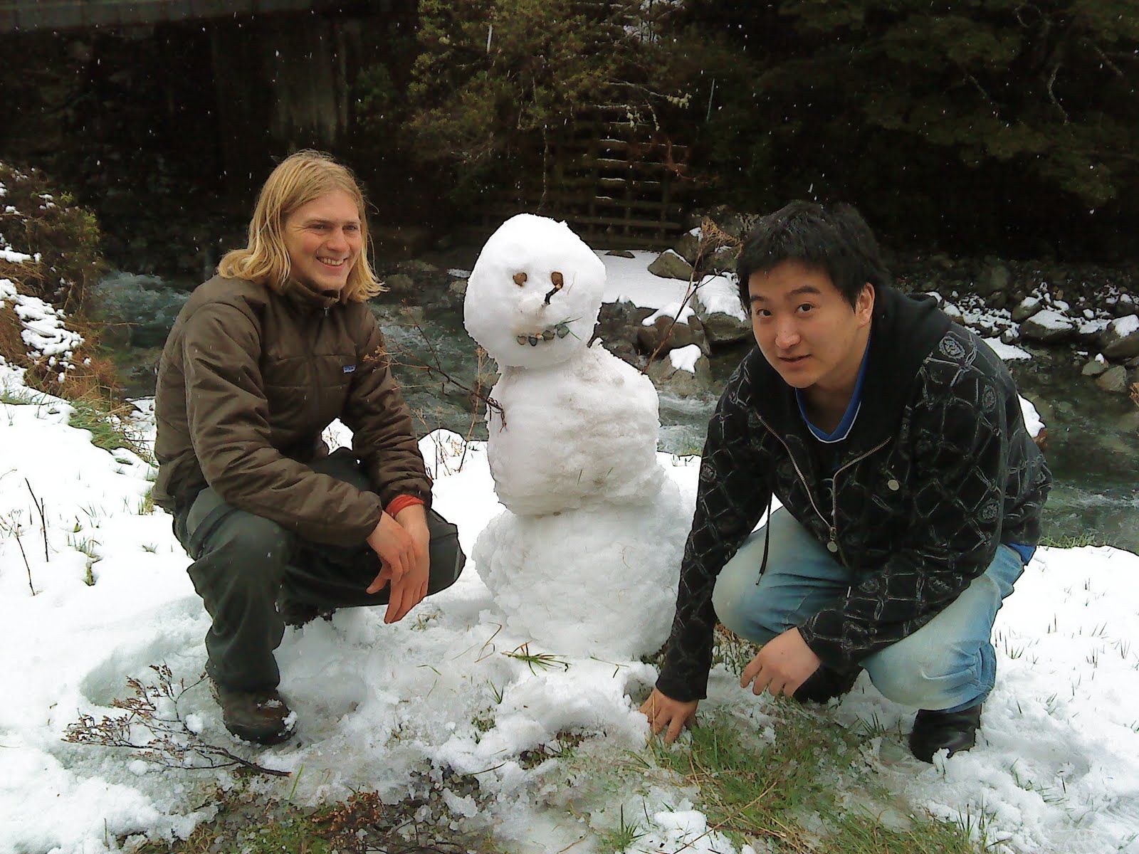
Final week of earthquake break came along and I decided that a jaunt on the queen charlotte track would be nice. Or rather I wanted to go to Nelson lakes and do the travers-sabine circuit but the weather forecast was for rain, wind, snow and more snow... not the best conditions for avalanche territory. A german friend in my glacier studies class, Marrie, was coming back from wellington and wanted to do something in the nelson region, and decided on the Queen Charlotte track in marlborough sounds. I told her I would meet her up there thursday when they sarted the track. Wednsday came, after a nice lazy day at Liz's, and I realized I probably should be in Picton (the closest town) that evening so I could actually get on the track thursday morning. I called Marrie and she said she had a friend hitching up from christchurch that day and i should see if i could join her. I tried the number but got no answer, sent off a text and waited for a reply. I flashed home on my bike to pack all my gear so I would be ready if I did get a response. But it was past 2 and it's a good 4 hour drive to Picton, so things weren't looking too good.

Indeed no response came and at 8:30 the next day, Thursday, I was on the road hoping for a ride. 2 hours later I was 30 minutes outside christchurch looking for another ride. Then I got a ride up towards Kaikora and finally felt i had started out, HOW. But I also Learned that the road to Kaikora was closed because of a landslide! what? yep, happened
four days ago and between two bridges so they couldn't get big diggers in there to clean it out. Luckily there was a detour and my ride took me half way through before dropping me off and heading towards his exploration of some neat little beach. From there a dog trainer picked me up and took me through the back roads of the Kaikoras. These mountains are small and rolling but come to large overbearing summits with commanding views of sea and souther alps. I just saw the seaveiw and didn't reach any summits, but look forward to doing a peak in the region at some point.


Coming into Kaikora is amazing: mt Feif rears from farms to bush and into snow to its 1600m summit. the farms extend to small houses a road and a strip of sand before the gaz wanders out to see and its infinite horizon. The sky is slightly overcast, just above the summit of fief. no sun spots make it down to the earth. But somehow all is wonderfully illuminated in a sacred calm. The surf crashes gently in eternity on that sandy shore that is littered with little black outcrops of coarse rock. A chimney is puffing smoke and the small sleepy town feels like a wonderful place of rest. I am tempted to call off my plans and stay there for some time. But a car halts and the driver moves his things to the back.


A california boy has suddenly decided to go renew his drivers license, but needs to go
toblenheim, the nearest semi big town in the northern part of the
island in order to do so. I will remind you that New Zealand has a population of 4 million, with only 1 million on the south island and 400 thousand of those in Christchurch. So we traveled, north, enjoying music, sharing stories, and speculating on the future. He likes to fish and I told him to feel free to give a ring anytime he's down near christchurch needing a place to stay. He dropped me in Blenheim so I made my way across town passing this bridge en route.

Final hitch to Picton was a wonderful older man, who just finished at his first job in a nursing home in Blenheim and now he was heading to Picton for a restaurant job. He owns a small farm and has a home near Picton. I really liked talking to him, though cant remember much of that conversation... unfortunate. Marrie texted to say they had ferried out to the track and planned to stay at bay of many coves campsite. It was almost four and I was sad I probably wouldn't be joining them. But my driver was optimistic that I could catch a ferry in Picton to join them that evening. Alas all the transport companies had returned for the day. I went around the harbor asking the fishermen and any other people near ships if they might be going out into the sounds andcoudl drop me anywhere along the track. The fishermen had all come in and were done for the evening. Though one, nicknamed shorty, said he'd give a call if he was going in the morning and could give me a ride then. I never did get a call from him.

I decided to give up on doing the track with them and decided to hitch from picton to either the start of the Queen Charlotte track or to another track. I was picked up by a wonderful german coming off the ferry from wellington. He had been living in wellington and was now headed to Nelson to join his wife and kids in the new house they had just bought on some land there. Great to practice my german a bit as we talked of weather and kids and jobs. He drove me an extra 7km up the side road to the start of the track, and we had amazing low sunlight penetrating under the clouds to illuminate the green valley that is the head of Queen Charlotte Sound.

I really started off! HOW! 5 pm and I was on the trail after hitching 530 odd km. I was goign the wrong direction... but I would cross paths with Marrie and might even spend a night in the same spot if things worked out. I had an hour of daylight and fully intended to make the most of it. Indeed those first few kms were some of the best. The sound has some interesting undulations at it's head, and the dipping sun nicely illuminated them.


I ran into some folks shortly after, first two girls who walked by with scarcly a nod. Then a boy who stopped and I radiantly greeted. One word out of Olly's mouth and my next question was: "wo?" My german mode was on and the next few minutes passed in german to his immense astonishment. Another boy caught up to him and I realized they were from Canterbury Uni as I had met his companion Daniel once. I told them they weren't from from the davis bay campsite which I had passed (wonderfull little beach, has some sand, but I briskly walked over it as i wanted to put some distance between myself in the start that evening). Then two more girls appeared, one of which I recognized, the four of them seemed a bti drained and I asked where they had started. From black rock shelter they said (some 20 odd km) and it had been a hard long day for them after the past two days of similarly lengthy days. I was eager to be off and get some more kms behind so I waved a
cheery *tschuss* and marched off. I ran into some goats on the trail, but they evaded the camera by dashing off into the spiky Goss. I knocked out some more kms but the sun was fading, setting the clouds ablaze to my delight. I said - next bend.. no the next bend - several times. Until at last the light no longer resided in the real of blaue stunde and I forced myself up into the bush. The Goss got thick quick and I had to set up camp slightly before I would have liked, and got Goss needles all over me. But the Hammock went up relatively smoothly, tarp and all. The dry Goss actually left a nice opening in the bush through which moonlight occasionally streamed. I cleared the floor a bit and set down to make and chow on some salami sandwiches. looking up through the needles (which occasionally wiggled their way into my behind or prickled down my back) The stars seemed to race past. Really the clouds were whipping by changing and flowing into eachother, dispersing to let the moon down. Constellations would be briefly framed before once again the clouds, like a mist, closed on them. I wriggled into my bed, my warm cozy sleeping bag made me sweat uncomfortably in the night but I slept well.

I woke early and completed the first 10 of the track to arrive in Mistletoe Bay there I first read the signs about needing a Queen Charlotte Track Land Cooperative (QCTLC) pass to walk the track. The lodge at Mistletoe Bay wasn't open yet so I couldn't get one there. I continued on to a summit from which to view the sounds and enjoy some musli and a pear for breki. I ditched my gear on the side of the track as I went up the side track to the lookout. Nice to drop the burden for a bit. The view was sweet as, looking along the ridgeline and seeing Queen Charlott sound and the more impressive and to me beautiful fingers of Pelorus and Kenepuru sounds. The clouds were thick above but let in shafts of early sun to cut into the restless waters of the sounds. All the constituents gave angry motions but together created a mural of a fast calm. Rooted were the surroundings, even the shifting sunbeams lent permanence to the scene.

Down from the views, into the bush, onwards. The track stayed for a time in a subalpine environment with lots of Goss on either side. The track is graded and two meters wide, easy. It stayed close to the ridgeline and would sometimes cross
over and a view of the sounds would be afforded, the light changed to sun now and again. I passed another sign telling me to get a QCTLC pass. I didn't want to detour to Portage lodge or whatever they call it so I sighed and commited to buy one when I returned to Picton. I passed off DOC lands and onto an odd section of grass, a bridal path for herding sheep that followed the ridgeline, and climbed steeply for a bit. Shortly after I
passed some other walkers. They too had
rain gear on against the odd showers that whipped up from time to time with light sprays. I passed down again from the Goss and into native bush. Lots of bush... some mud, some slightly steeped bits, but always graded. Then up again and into more Goss. The winds were picking up and with them gathering greys.

The gusts pushed up over the ridge from the west to then dive down into the bays of Queen Charlotte. The intense pressure left flat depressions on the water which boiled outwards, sometimes kicked up into a fury of white spray that danced and swirled into the air. Turning over a ridgeline I watched it all in amzement. Descending agin somewhat into the bush I passed a sign indicating access to a privatle lodge along the track and warning: Not maintained by DOC: for experienced trampers only! I laughed and sidled on along
the smooth and graded DOC track. A gap in the bush where a tree had fallen allowed for another look into the sound and the paintings of the wind.


And then I was at the black rock shelter; just in time, for 5 minutes post arrival the winds reached a gale and brought rain beating down against the back of the shelter. A perfect time for some banana peanut butter sandwiches for lunch ay? I enjoyed my yummy, listened to the gale and tried to record some of it as well. The hexagonal shelter kept me nice and dry and out of the wind. I figured I'd fill in the DOC book since they tel you to always fill em out when you pass. But I was naughty and picked a bunch of sweet smelling yellow Goss flowers, stuck em in the book and wrote "flowers!" as my intended purpose of the journey. Bundling up against another possible shower I was back on the trail.


I passed a walker engrossed in his headphones and was sad. Then on through more bush. The clouds lifted for a bit and I had some nice views of the bush, and then some openings allowed views of the sound and bush covered hills. Rain came in spurts, and now and again I even got some hail. I was approaching the Bay of Many Coves shelter, but had not passed Marrie. I got out my phone and sent a text to see where they might be. The weather began clearing again and when I reached the shelter I had sunshine and a nice clear view over the sound. I sat on the stoop and ate some scroggin, ei gorp. The girls it turned out had spent the night at the shelter, but the storm had hit them and soaked their gear. So they had to turn back and take the ferry back into Picton. I was sorry to hear that but excited at the prospect of getting the whole track done and had enjoyed the views, if few and far between, thus far. Back onto the track I determined to
get passed a longish section on the western aspect and onto the more sheltered eastern side of the ridge before nightfall. The path moved onto the west side of the ridgeline and the wind was intense. Howling up and through the trees trying to pass over the obstruction that separated the sounds. It's fury almost caught me as I walked into an opening beneath some powerlines. The full force of wind, unfiltered by trees, came and nearly blew me over. I staggered, but smiled and continued on, chuckling. In and out of the bush, as I passed over small ridgelines, wearing my rain jacket more for the wind than anything, but the rain was coming again as well. And with the wind the rain was horizontal and very strong. On one bend a tree had lost its footing and was bending into the path. A tangle of roots unable to hold dirt spread over the path. The edge was rather steep and so I had to clamber over awkwardly.

The wind really was howling and I was getting a bit nervous about how the night might turn out. I knew I needed to get on the eastern aspect to avoid the full brunt of the wind. This notion was reenforced when I took another little side trail to a lookout. Howling winds tore at the nonnative pine trees around the track and small branches had been blown down. At the lookout the wind was strong and rain blew into me, making it difficult to see any sights and also rather unpleasant. There was a picnic bench and a sign pointing the direction and distance to many famous places around the globe... But I felt cold and so preoccupied so wandered back down from that windy place. I stopped in another saddle where the wind was blowing, this time with less rain, and the clouds were higher. I was behind a thin line of trees and looking down into Queen Charlotte sound I watched the play of wind on water making wave and spray. Captivating are the horseshoes that grow out of flat waters in the bays. Dark greens, deep deep blues, and then white caps and spray all under grey dormant clouds. in that vantage the rain started, and so I marched on into the shelter of the bush.

I began to descend, and finally crossed over the ridge and onto the eastern face. I continued on to reach lower elevations free of Goss, and kept my eyes open for a thin section of bush in which to set up my hammock. Today's wildlife appeared as a couple of wecca ambled across the tack. They were a bit cautious, but not frightened of me at all. Odd flightless New Zealand birds. nice brown
color and large yellow beaks. I was psyched to see them! Soon after I found my spot in the bush. I moved out away from the track and found some sturdy trees. Took a bit longer to set up camp as I was a bit drained by the last few hours rain. Though at the moment it was clear (you could tell by the light since you couldn't really see out of the bush). I still had a few hours tell dark so took it easy. By the time the tarp was all stretched out it started to drizzle, so I crawled into the hammock and had dinner in there. No moon tonight, but I pulled out my Sheepskin, which kept the back nice and toasty, and left my sleeping bag open. I stayed a much better temperature and had some pleasant dreams though I cant recall them now.

I woke in the morning just after dawn, having slept soundly through the night, I chose a nicely sheltered spot and had had very little wind, though the rain had come down hard at times. Packing up some more Wecca appeared. which was nice, at first. But then they started moving towards my bag, and their sharp beaks took some strong jabs at my pack and food bag. I had to shoo them off a bit then, though they persistently snuck back. It was a bit later, this morning, maybe an hour after dawn? So I was eager to be off, and the urgings of the wecca expedited the tear down of camp.

Back up the slope, through the fragile trees that were still standing in spite of rot, wind, and rain. Under some pines with towering branches thick with needles. The track was moist, and as I came around and down into Endeavor Inlet the air thickened and rain began to come. this rain was different, the wind was softer. A more misty rain, but unsteady and the clouds were high and a lot of light filtered through. Really just the occasional sprinkle, though up above I watched the tormented clouds and knew there was wind.

Down along the shore of the bay now I kept a weary eye for an a place to eat a full breakfast. I had a banana at camp but I hadn't wanted a full meal just yet. An overlook wasn't likely to occur, But I noticed a nice little beach across the undulation in the inlet I was following that shouldn't be too far away and made that my goal. I was bundled up with hat and wet gloves and rain-jacket against the spitting of the sky. The morning was chilly without a sun and my hands were very chilled. At the head of the bay the stream which formed that undulation appeared. A good sized river, the biggest I had seen yet on the track. I noticed a side path and took it, I knew it would go towards the beach where the stream joined the sea (I'm on an ocean incase you forgot!) But another branch veered off back to the path, as I had hoped, and led me into the stream. Felt good to get my feet wet in wading after having crossed so many bridges.

The track started to climb and I worried I would miss my beach. I stopped at an interesting Tree next to the Path that served as an umbrella for a view out of Endeavor Inlet. And just down from the tree was my beach! I scrambled down a steep bit and onto the rocky beach. What strange rocks! They looked as if corroded and etched by acid. They had cool pock mark holes in them and were a stunning warm reddish hue. A small space, maybe 15m wide, backed by a 2-3m high wall of crumbling earth, tree branches strewn and neglected as they stretched down towards the beach. Fully hungry now I extracted my musli and a pear from my pack and sat on a rock to enjoy. A stiff breez was still nipping and I discovered my fingers flacid and noncooperative. I struggled to close them around the spoon, and couldn't hold the fingers together to scoop out the musli. The result was I spilled a lot of musli, and the paradise ducks I watched playing on the water probly got a nice meal from it too. Satisfied I scanned the stones and selected a few holy ones. Rubbing my hands I reorganized, storing my treasures, and scrambled back up the slope. I was eager to try and get to Ships cove that afternoon, early enough to catch a ferry back to Picton and with luck hitch back to christchurch.

The trail then was more of the same. up down, up down, the views restricted to the waters of the inlet and less of the sounds proper. I then came down into the head of the Inlet itself an miners camp. Miners settled there at one point mining adamantine ore. The ore was of low grade unfortunately and now it is a quirky place of a few farm animals and curious shacks. Farther on the fancy vacation homes and resorts popped up. I stopped at one to retie my shoes and say hi to an older gentleman living there. After the homes I passed a cool turn off to a waterfall, but I wanted to make ships cove and so pressed on. Just after was another sweet
little rock beach. And then began the climb up out of Endeavor Inlet over to resolution bay. I ran into some cyclists, and just after thier passing heard a tire blow, and someone shouted, "thats the third one today!" The forrest here was sweet and there were some cool half lookouts that just had very nice light, though no real views of the sounds. Up farther and I caught glimpses of the saddle that was the top. The trees felt very healthy hear, and the hillside murmered with trickling-seeping water. The sky had cleared and I now watched soft cumulous racing overhead. At the saddle was first a toilet. I used it. Then, a steep descent on switchbacks to a sweet little farm. I thought sustainable, but what do I know. At any rate they had some cool shelters set up and running free across the path were chickens! I really liked that place. felt like a good home, I wish i remembered the name cause I think you can stay there and I would recommend it over the other places I passed.

It was 2 and I knew I wouldnt make it to ships cove that day. I saw a turn for another campground at a beach and went there. School house bay, not that nice, but I had a good time. Another landslide had covered that path so I got to scramble over that. Then I Sat on the beach and set out some things to airout/dry. I stripped down and prepared for a bath. The wind was chilly, but the sun warm so I had my eye on the clouds and waited tell none were coming. Then I dashed into the water and freaked out! oiy! chilly cold salty water, refreshing as a mountain stream. I dipped, dove, and sprang out gasping a few
times. Then found a semi sheltered spot from the wind and commanded the sun to dry me. That worked a bit, and then I ventured out into the wind and that dried off the rest. Waiting I ate and watched the waves crashing on a protrusion in the beach. Lunch was yummy, and when I felt I was all dry I set off at a leisurely pace for ships cove.

One final Saddle to reach. the path curved up towards it and I caught many glimpses of it through the tree tops. At that top was the view of all views. A notch in the trees allowed unhindered observation of the outermost sounds. The fingers of Queen Charlotte Sound fully spread, grasping brothers island and the eyes of the octopus. On the horizon could be seen a mass of cloud, hovering above the north island. I knew wellington was getting hammered in the storm even if the clouds had passed me for now. I loved it. and drank it in.

I was also ready to make camp and wanted to do so early, plus there was a waterfall at ship cove to explore. I got to the cove, noted the toilets, pier, grass, monument, and beach. Then moved on towards the waterfall keeping an eye out for likely hammock areas. I spotted one and ditched my pack. I visited the waterfall and recalled conversations from the Routburn track when we wanted to bath under one. There were multiple falls. The main ones in front of me were two, one large and boisterous to the left, another thinner and concentrated into a nice shower head falling just out from the rock into a pool. The trees were very thick, and some clouds I think added to the gloom, I was surprisingly tired. There were other falls behind and a second stream with smaller cascades to the right. I went up above, stepping gingerly through tangled vines and slippery stones. I found where the lower falls diverted into two streams and blocked off some of the bigger flow. When I got back down the smaller fall was falling well into the pool and I made a note of the spot incase I wanted a shower in the morning.

I went back to my pack, wandered up into the woods and found some nice trees next to a tree fern. This was the first camp on nearly flat ground. I again wanted another length of rope and used my kite lines instead. I was set well before dark, but the clouds dulled any sunset and I felt wind and rain coming on. I ate and dusk under the clouds fell. I bundled into my hammock and sleeping bag as it was dark and the wind picked up. But I couldn't sleep for some reason. I listened to the wind and the fern tree rubbing on the tarp. Then the rain came and cackled along the tarp, running off the side: in rivulets, and gathering to a stream near one of the lines. At last I slept. Slept tell morning and tinges of orange on the sky.

I quickly took things down as the new day was bright and sunny. I moved down to the beach at ships cove then. I dismissed the shady, cold, waterfall shower option, and contemplated another swim in the ocean. I ate some musli. drew some postcards. I slowly stripped down, letting the sun get stronger, as the wind had never left. I did then venture in. A long beach it was and hard to swim. I waded out some 20 meters and still only thigh deep. I suddenly felt a little pain in my back. then my arm. Sandflies? dammit there's sandflies! I then dove into the water and enjoyed some flundering, today with fewer gasps. before wading back to shore. I then was constantly moving to avoid the sand flies. I collected rounded stones from the stream there. Then sat on a log and did some more sketching and postcard writing. Then back to the stones and I discovered that the large stones were mud stone and easily broken. I broke some and then arranged my collections in an interesting fashion. I put on some clothes to keep off the sand flies but kept roaming, sketching, sculpting. Moving between yoga poses and feeling the sand (yep this beach was sanding rather than stoney) in toes and on legs and arms.

I saw a boat arrive and went out to the pier. Then I saw the blue waters there and really wanted to dive in. But I had dried and didn't want to again, plus I knew the boat ride would be windy and a windy wet boat ride would be COLD! the boat though was just dropping off and wasn't going to Picton. but shortly a Picton boat arrived. The sounds by boat arnt too flash either, your too low to the water. But some of the shore line is cool and you see more of it. You also see that alot more of the sounds are covered in nonnative, ugly, pine. I helped the boat driver land at docks and laod and unload some goods for people. But I still had to pay when We got backinto Picton.

A quick stop at the isght to buy my Queen Charlott Track Land Cooperative pass. Then to hitch! To blenheim in a wicked van with kids slowly going to christchurch to see metalica. Then from belnheim with a very cool indain dude from kashimier who had some things to say.

Epic. 2 days driving for 1060 km. 2 days walking 75km

HOW